Neighborhood for Playing: Using GPS, GIS & accelerometry to delineate areas within which youth are physically active.
The full research paper is published in Urban Studies titled as Neighbourhood for Playing: Using GPS, GIS and Accelerometry to Delineate Areas within which Youth are Physically Active, co-authored by Li Yin, Samina Raja, Yuan Lai, Xiao Li, Leonard Epstein, and James Roemmich.
The detailed space-time-activity trajectories at the individual level based on GPS, travel diary, GIS, and accelerometer are useful for planners to examine and define the playing spaces around children’s homes. We compared actual play neighborhoods of our subjects where most moderate and vigorous activities occurred with the predominant half-mile area using a mix of visual and statistical methods.
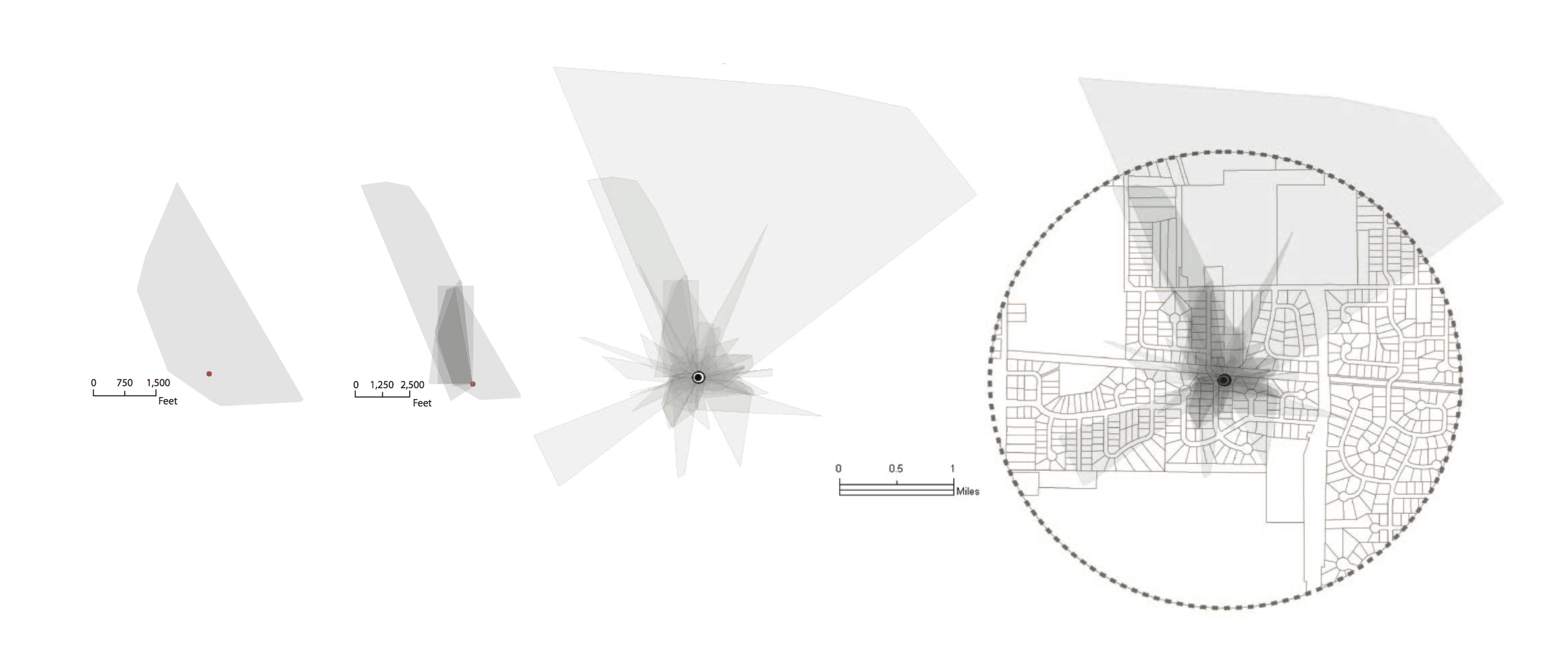
The results of the study will help planners and physical activity investigators understand the extent of children’s play neighborhoods. This study found that children do not use their neighborhood equally in all directions. Their activities usually focus on only one or two directions or sections within a circled neighborhood, yet often it is built environment attributes within the entire circled neighborhood that are used to determine the association of the built environment with the physical activity or adiposity of youth and adults.
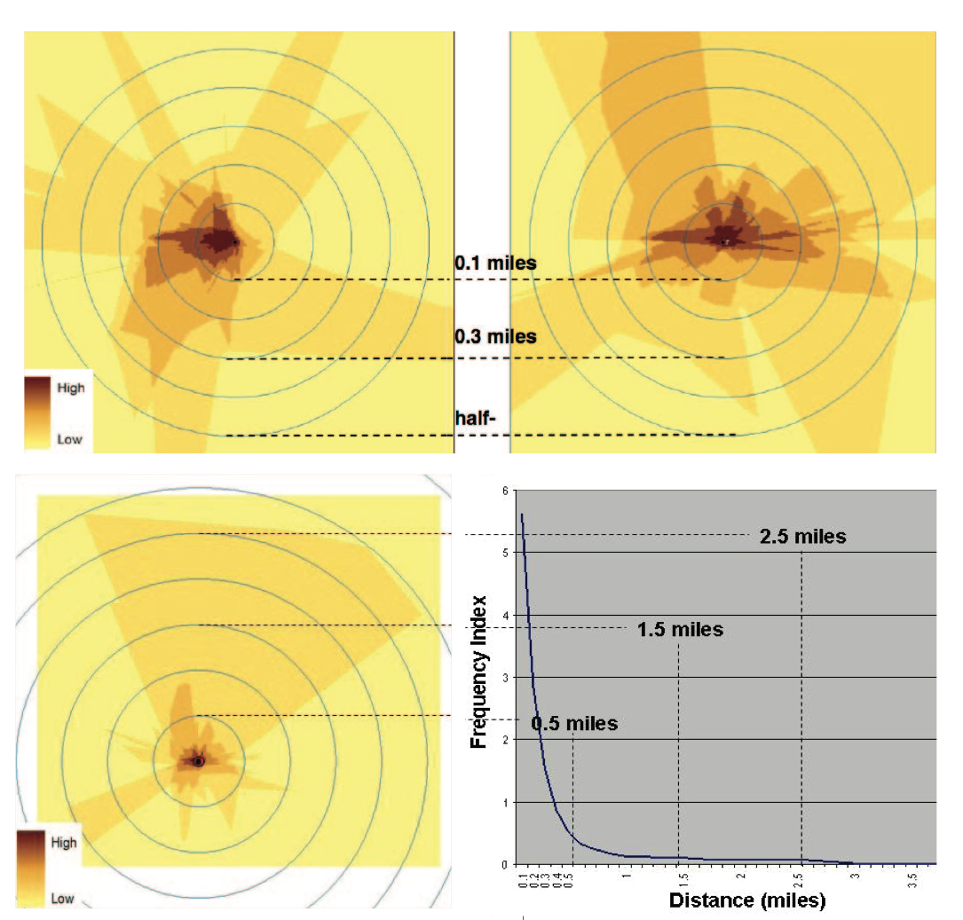
Using circled neighborhoods, such as the half-mile radius, and calculating built environment variables based on these circled neighborhoods as done in many previous studies may have misrepresented the neighborhood environment characteristics and their contribution to physical activity by including neighborhood attributes that children do not use or experience. The half-mile radius for people’s neighborhoods used in many studies may be a reasonable assumption for general population, but it tends to be larger than the areas used most often by children. This study recommends using a quarter-mile or three-tenth-mile radius for children’s walking and play neighborhood.