

My Home Page
|
|
|
||||
| Island Peak Approach | |||||
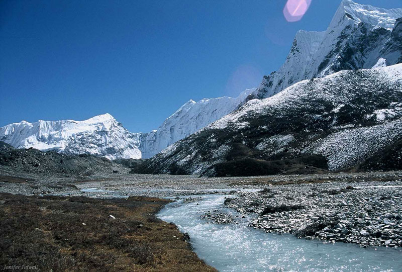
| Day 17: After spending a night in Chukkung, we trekked to Island Peak Base Camp. The landscape was rough and somewhat bleak, but we walked through this pastoral valley on the way. The Imja Khola -- it's baby blue, honest to God, I did not doctor this photograph -- runs cold and fast through here, descending from a glacier next to Island Peak (Imja Tse). What doesn't show up in this picture are the glacial erratic boulders scattered around the valley floor. Some of them were 12-foot cubes, as if a giant had been playing dice in the valley... | |||||
|
|
|||||
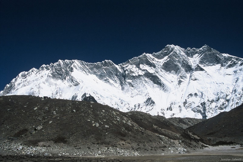
| The immense Lhotse wall towered over us on the left as we walked towards base camp. This picture cannot possibly give you an appropriate sense of scale. Island Peak -- a nontrivial 4000-foot climb -- is dwarfed next to this thing. (That black slope on the right is Island Peak, by the way.) You might see a horizontal band of yellowish streaks near the top of the ridge; this is the same geological feature as the Yellow Band on Everest. Luis says that fossils are sometimes found there. Lhotse, however, is rarely climbed. | |||||
|
|
|||||
|
|
Next | ||||
|
|
|||||
|
Back to Beginning
My Home Page |
Text and images © 2001 by Jenifer Tidwell | ||||