|
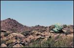
Highway frog
|
Sm
Med
Lg
Full
|
|
Description :
|
A giant frog sitting alongside the highway
| |
Location :
|
AZ-89 just north of AZ-71
| |
Date :
|
14 Jun 2003
| |
Comment :
|
LEAD Technologies Inc. V1.01
|
| |  |
| |
|
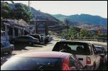
AZ-89A in Jerome
|
Sm
Med
Lg
Full
|
|
Description :
|
AZ-89A, the main street running through Jerome, AZ. This is the main road connecting Prescott to Sedona; as it passes through Jerome, it becomes a narrow, twisting road with buildings close along the road on both sides.
| |
Location :
|
Jerome, AZ
| |
Date :
|
14 Jun 2003
| |
Comment :
|
LEAD Technologies Inc. V1.01
|
| |  |
| |
|
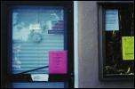
"Please Use Other Door"
|
Sm
Med
Lg
Full
|
|
Description :
|
The door of the town clerk's office in Jerome, AZ.
| |
Location :
|
Jerome, AZ town hall
| |
Date :
|
14 Jun 2003
| |
Comment :
|
LEAD Technologies Inc. V1.01
|
| |  |
| |
|
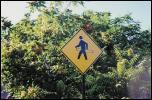
Hula Hoop Crossing
|
Sm
Med
Lg
Full
|
|
Description :
|
Hula Hoop Crossing
| |
Location :
|
Jerome, AZ
| |
Date :
|
14 Jun 2003
| |
Comment :
|
LEAD Technologies Inc. V1.01
|
| |  |
| |
|
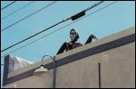
Death
|
Sm
Med
Lg
Full
|
|
Description :
|
Death, on top of a building.
| |
Location :
|
Prescott, AZ
| |
Date :
|
14 Jun 2003
| |
Comment :
|
LEAD Technologies Inc. V1.01
|
| |  |
| |
|
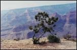
Joshua Tree
|
Sm
Med
Lg
Full
|
|
Description :
|
A small joshua tree on the edge of the Grand Canyon.
| |
Location :
|
Rim Trail, South Rim, Grand Canyon NP
| |
Date :
|
15 Jun 2003
| |
Comment :
|
LEAD Technologies Inc. V1.01
|
| |  |
| |
|
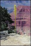
Strange Plant
|
Sm
Med
Lg
Full
|
|
Description :
|
An as-of-yet unidentified plant on the edge of the Grand Canyon.
| |
Location :
|
Rim Trail, South Rim, Grand Canyon NP
| |
Date :
|
15 Jun 2003
| |
Comment :
|
LEAD Technologies Inc. V1.01
|
| |  |
| |
|
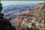
Canyon View 1
|
Sm
Med
Lg
Full
|
|
Description :
|
A view of the Grand Canyon.
| |
Location :
|
Rim Trail, South Rim, Grand Canyon NP
| |
Date :
|
15 Jun 2003
| |
Comment :
|
LEAD Technologies Inc. V1.01
|
| |  |
| |
|
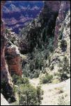
Canyon View 2
|
Sm
Med
Lg
Full
|
|
Description :
|
A view of the Grand Canyon.
| |
Location :
|
Rim Trail, South Rim, Grand Canyon NP
| |
Date :
|
15 Jun 2003
| |
Comment :
|
LEAD Technologies Inc. V1.01
|
| |  |
| |
|
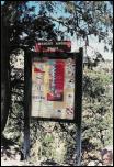
Bright Angel Sign
|
Sm
Med
Lg
Full
|
|
Description :
|
Sign at the top of the Bright Angel Trail, leading down into the Grand Canyon. Posters include warnings about packing out your trash, as well as dire warnings about heat: you cannot hike to the bottom of the canyon and back in a single day. A later sign gives recommended endpoints for day hikes, depending on how early you're leaving and how much water you have.
| |
Location :
|
Bright Angel Trail, South Rim, Grand Canyon NP
| |
Date :
|
16 Jun 2003
| |
Comment :
|
LEAD Technologies Inc. V1.01
|
| |  |
| |
|
Shoe Hack
|
Sm
Med
Lg
Full
|
|
Description :
|
Repairs on a broken shoe. The sole of the shoe was coming off; we used medical tape from a first-aid kit to tape the sole on. This is the "after" picture, after a mile of uphill hiking.
| |
Location :
|
Bright Angel Trail, South Rim, Grand Canyon NP
| |
Date :
|
16 Jun 2003
| |
Comment :
|
LEAD Technologies Inc. V1.01
|
| |  |
| |
|
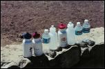
Depleted Water
|
Sm
Med
Lg
Full
|
|
Description :
|
Empty water bottles after the hike. We went as far as the 1 1/2-Mile Resthouse, and then came back up. Going down, three people drank a total of 3 pints of water, then at the bottom, drank two more pints and refilled; this, plus the eight pints here, is a total of 13 pints (a gallon and a half, or about 6.5 liters) for three people for four hours of hiking.
| |
Location :
|
Bright Angel Trail, South Rim, Grand Canyon NP
| |
Date :
|
16 Jun 2003
| |
Comment :
|
LEAD Technologies Inc. V1.01
|
| |  |
| |
|
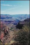
Canyon View 3
|
Sm
Med
Lg
Full
|
|
Description :
|
Looking down along the Bright Angel Trail, which is visible here. The green patch in the very middle is Indian Garden, which is the longest recommended day hike, and then only if you leave before 7 AM. The 1 1/2 and 3 Mile Resthouses are much closer in, but not visible here.
| |
Location :
|
Bright Angel Trail, South Rim, Grand Canyon NP
| |
Date :
|
16 Jun 2003
| |
Comment :
|
LEAD Technologies Inc. V1.01
|
| |  |
| |
|
Descending Mules
|
Sm
Med
Lg
Full
|
|
Description :
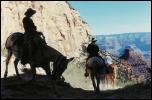
|
Mule trains make the descent along the Bright Angel Trail from the South Rim to Phantom Ranch at the bottom of the Grand Canyon.
| |
Location :
|
Bright Angel Trail, South Rim, Grand Canyon NP
| |
Date :
|
16 Jun 2003
| |
Comment :
|
LEAD Technologies Inc. V1.01
|
| |  |
| |
|
Find the Lizard!
|
Sm
Med
Lg
Full
|
|
Description :
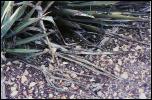
|
The native lizards are very good at blending in with the local surroundings.
| |
Location :
|
Rim Trail, South Rim, Grand Canyon NP
| |
Date :
|
15 Jun 2003
| |
Comment :
|
LEAD Technologies Inc. V1.01
|
| |  |
| |
|
Canyon View 4
|
Sm
Med
Lg
Full
|
|
Description :
|
A bird soars above the Grand Canyon. The Colorado River is visible below.
| |
Location :
|
Rim Trail, South Rim, Grand Canyon NP
| |
Date :
|
15 Jun 2003
| |
Comment :
|
LEAD Technologies Inc. V1.01
|
| |  |
| |
|
Canyon View 5
|
Sm
Med
Lg
Full
|
|
Description :
|
A view to the west along the Grand Canyon. The Colorado River is visible below.
| |
Location :
|
Rim Trail, South Rim, Grand Canyon NP
| |
Date :
|
15 Jun 2003
| |
Comment :
|
LEAD Technologies Inc. V1.01
|
| |  |
| |
|
Natural Bridge
|
Sm
Med
Lg
Full
|
|
Description :
|
A natural bridge to an observation point at Cape Royal on the North Rim of the Grand Canyon.
| |
Location :
|
Cape Royal, North Rim, Grand Canyon NP
| |
Date :
|
17 Jun 2003
| |
Comment :
|
LEAD Technologies Inc. V1.01
|
| |  |
| |
|
Me
|
Sm
Med
Lg
Full
|
|
Description :
|
Me at the south rim of the Grand Canyon.
| |
Location :
|
South Rim, Grand Canyon NP
| |
Date :
|
15 Jun 2003
| |
Comment :
|
Created with The GIMP
|
| |  |
| |
|
Dad and I
|
Sm
Med
Lg
Full
|
|
Description :
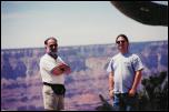
|
My father and I at the south rim of the Grand Canyon.
| |
Location :
|
South Rim, Grand Canyon NP
| |
Date :
|
16 Jun 2003
| |
Comment :
|
Created with The GIMP
|
| |  |
| |
|
Flat Mountain
|
Sm
Med
Lg
Full
|
|
Description :
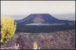
|
Looking to the east, a flat mountain is visible beyond the Grand Canyon.
| |
Location :
|
Desert View, South Rim, Grand Canyon NP
| |
Date :
|
16 Jun 2003
| |
Comment :
|
Created with The GIMP
|
| |  |
| |