Danube, Day 1
Leaving Vienna
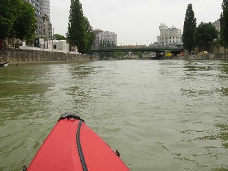
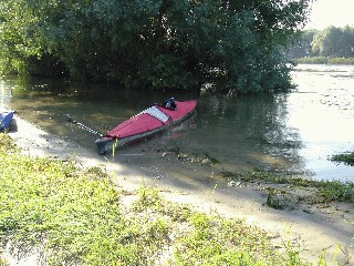
I took the subway to reach the Danube canal in Vienna, from where I assembled and launched my kayak. It was overcast, but very warm.
On the water it's 25-30 degree C--still comfortable.
Children waved from bridges overhead and, as the canal joins the main river,
Vienna gradually recedes behind me.
Outside of Vienna, the shores were lined with marshes
and trees (willows, popular), with the occasional cottage
and its fishing net hanging from a
pole.
.
.
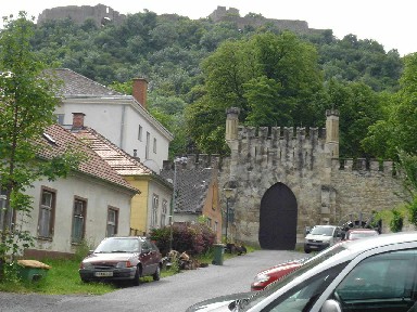
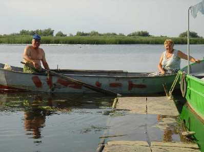
Hainburg, Austria
By late afternoon, I reached the historic town Hainburg an der Donau, where I stopped
for the night. I asked a local for camping platz and was directed to a grassy
area by the river on the east side of the town. Only problem: Mobs of mosquitos that
considered me fine dining.
The town has a well preserved wall and gate and a castle ruin on a hill top (closed for repair), among other historic sites. It's water front also makes for a pleasant evening walk-if not for the mosquitos. The railway runs parallel to the shoreline over a stone viaduct. Peaceful and picturesque.
A thunderstorm blew through at night,
which made for a dramatic backdrop over the Danube.
.
.
.
Danube, Day 2
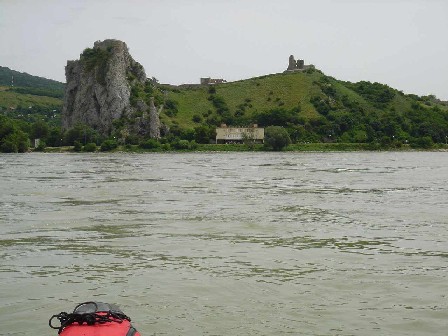
Between Slovakia and Hungary
The rain finally relented in the morning. After a walk along the shore to explore more ruins (and breakfasted by mosquitos), I decamped to resume my travel. The current is swift (about 4-5 km/hr) on this stretch of the Danube, and I was making fast progress. Occasionally a hydrofoil or a cruise ship or a freighter passes by. Now the river flows between Slovakia and Hungary. Here is a castle ruin perched on a hill top on the Slovakia side.
.
.
.
.
.
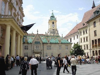
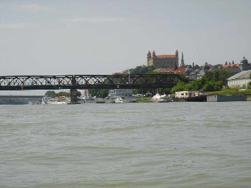
I reached Bratislava at around noon. I stopped for about 1.5 hr to visit the main town center, which is compact and graced by fine baroque-style architecture amidst its many restaurants and shops.
.
.
.
.
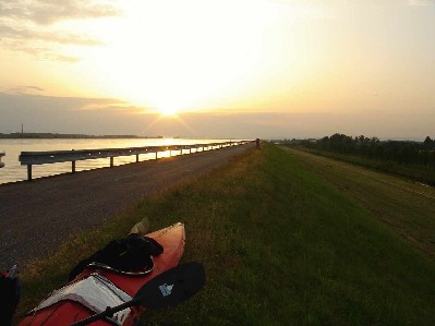
Birds abound on this stretch of the Danube (ducks, egrets, swallows, gulls, terns, even swans). By late afternoon, I was still far from any town, so I got off the river (in fact, I was in a canal, straight as an arrow) and camped on the grassy embankment in the Slovakia country side. A bike/motorcycle path runs along the shore, but it was very quiet by this time. There was a fresh breeze, a lovely sunset, and a chorus of frog songs to fall sleep to.
.
.
.
.
.
Danube, Days 3-4
Komarom and Esztergom
I woke to a cloudy and breezy morning. Lots of waves on the river, but no
whitecaps. And the wind was in my back. Soon (after 45
minutes or so) I reached the hydro-electric dam at Tejke. A Slovakian policeman
ordered me to get out of the river and portage my kayak across the dam.
The distance of the
portage was about 1 km, so I was grateful for the relative light weight of
my kayak. It also attracted questions from curious workers there.
Below the dam, the flow was languid initially but
gradually speeded up. Now the river
sometimes narrowed and sometimes widened immensely, dotted by islets inhabited
by waterbirds.
The flow sometimes slowed and sometimes speeded up, possibly in different
directions and some in swirling eddies or in standing waves.
One time a black-faced tern repeatedly circled over my kayak, making a lot
of sounds, and would fly low towards my kayak and then lift up just before
reaching the kayak. For most of the time, it was just the wind, water, and
sky.
By about 6 pm, I reached the town of Komarom in Hungary. I asked for
camping platz and was directed to a beach quite far from the town.
Fortunately I was able to find a fruit market and a food market not too far
away, so I could replenish my provisions.
It was a nice sandy beach in a forest surrounding, and the day ended
with another nice sunset. But many mosquitos (and I forgot to bring
repellent).
Next morning began with greyish sky, but the clouds gradually
lifted to a bright sunny afternoon. The shores were well forested, filled with
birdsongs in the morning. Cottages and sandy beaches occasionally peek out
from behind trees. I came upon some surprised bathers in the more
secluded beaches. I reached Esztergom in Hungary in early afternoon, and was glad to
find a
camp site with washing facilities at Grand Camping, so I could wash my clothes a bit.
It also had a pool for a relaxing dip.
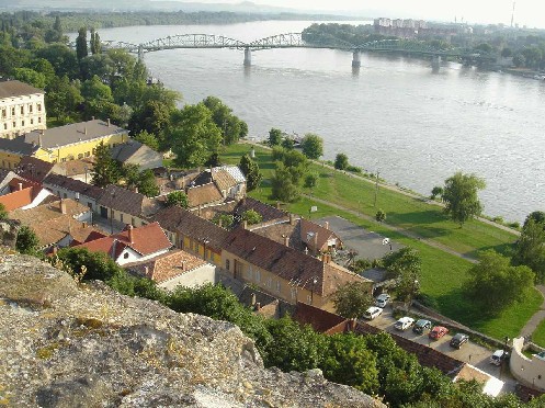
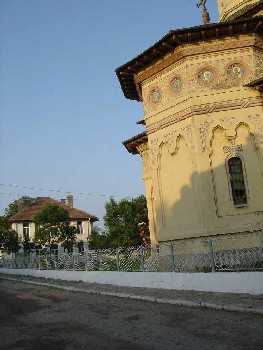
Esztergom has an impressive basilika (the largest in Hungary) with a sweeping view of the Danube valley, as well as other historic churches. Its
city center is pleasant, crossed by a tributary of the Danube where a festival was held.
I found a internet cafe to keep in touch with my other worlds.
Danube, Day 5-6
Danube bend, Szentendre, and Budapest
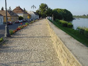
After decamping, my kayaking continued eastward on the Danube, with farms and forests lining both shores, until I reached Visegrad, with its castle ruin (partially restored) standing a lonely vigil on a hill top over the famous Danube bend. A reminder of ages gone by. Here the Danube is split into two branches by a large island and I took the shorter and narrower Szentendre branch. Now the Danube felt more intimate, with shores close together, lined by willows waving their branches in the wind. Small motor boats, kayaks, and canoes abound. I reached the pleasant town of Szentendre, about 19 km north of Budapest, in the afternoon, and decided to stay there overnight instead of continuing on to Budapest. However, due to some confused information in my Lonely Planet guidebook (or my confused reading of it), it took me more than an hour to find the camping platz, which is located on a little island about 1 km north of Szentendre. The town itself has a quiet charm, with little shops/restaurants (for tourists mainly) lining narrow cobble-stone streets, and an attractive river walkway. A hill top in the town centre offers a nice sunset view of the Danube valley and cooling breezes.
Next morning, I decamped, packed away my kayak and caught a bus for Budapest. Once in Budapest, I used the underground metro to reach the train station, which became a bit of an adventure since some parts of the metro were closed for repair and I had to find a shuttle bus above ground to get around the closed parts. I booked the 6 pm train for Bucharest, arriving 9 am next morning. I had to explain to the Hungarian police on two occasions why my passport lacked the stamp from Austria-Hungary border check, but they were nice enough to let me continue onward to Romania (though with a warning that I do not enter Hungary by kayak again!)
Bucharest, Tulcea, Danube delta, Day 7
Arriving in Bucharest train station (gara de nord) in the morning, I had my one `negative'
experience. I was approached by a man who spoke English and who wanted to
`help me'. Normally I would be wary of such individual, but he was able to
gain enough trust from me that I agreed to let him drive me to the station
where minibus leave for the Danube delta. I asked for an estimate of the
cost, which seemed reasonable. However, I didn't know that Romania had
issued a new Lei currency (my guidebook only refers to the old Lei currency)
and, in the confusion, I gave this man 10 times the amount I should have.
This was later explained to me by a young German couple, who were also going
to the Danube delta in the same minibus.
As we left Bucharest, it was both
sobering and fascinating to see the legacy left by Ceausescu, in all its
grandiose pretensions. Gradually, grey buildings gave way to rolling hills
of farmlands and forests, dotted by marshes. Signs of flooding from the
Danube are sometimes still visible. After about 4.5 hrs on the road, we
arrived in Tulcea, the gateway to the Danube delta (a UNESCO world heritage
site), at about 3:30 pm.
Like many port town, Tulcea is functional but not
so pleasant to stay in.
I set about assembling my kayak (after getting
map/permits for the delta and food/water).
After I launched my kayak into the harbour, a
patrol boat ordered me to stop and to show the papers for my kayak
as well as my passport. After some questions/debates and a mobile phone call,
the captain of
the patrol boat returned my passport and let me continue on--much to my
relief. Thus, as the sun began to set over the fields and willow trees, I
found myself in the last leg of Danube's march into
the sea. At dusk, I found a nice camp site on a sandbar by the river's
shore, sheltered by a cluster of willow trees, and with a cooling breeze to
relieve the heat. The clear water and soft sand made for an inviting bath
to wash away the day's weariness. As night falls, stars filled the sky and
a chorus of frog songs filled my dreams.
.
Danube delta, Day 8
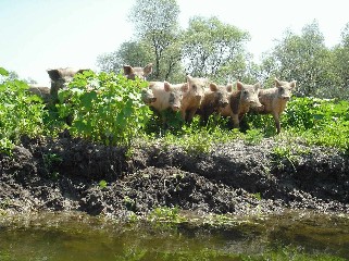
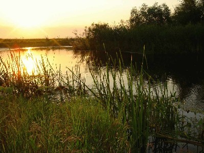
I awoke to a sunny and warm morning. The Danube had by now split into three branches which form the delta. I was on the shortest (and most popular) branch, which flows for about 71 km from Tulcea into the Black Sea at Sulina. Here, human farming, logging, and engineering has reshaped much of the land (for good or bad). Still, parts of the delta have been left more or less untouched, a watery paradise they remain. How long they can last is hard to say.. I explored some of the maze-like inner waterways, careful not to get lost, and marvelled at the richness of the animal/plant lives above and below the water. The marshes of reeds and willows, populars filter the water and provide shelter and habitat for birds, fish, insects, amphibians of all sorts. Near lake Furtuna, I came face-to-face with a family of ``pigs gone wild'', who followed my kayak with great curiousity. In the late afternoon, I made camp at a little bay, about 8 km west of Sulina, from which I could see pelicans, cormorants, terns (diving to catch fishes), egrets, hurons,... Another beautiful sunset over the delta, in hues of orange, pink, purple. Overnight, some curious animals came by and left muddy footprints on my kayak.
Danube delta, Sulina, Day 9
Yet another sunny and warm morning greeted me. But perhaps as a reminder
that paradise is relative, I found a leech attached to my paddle.
Suddenly the water
felt less inviting.. As I approached Sulina, more boats and ships,
large and small, came passing by. The current flows strongly in mid river,
but weakens near the shore (important for going up river).
I went past the main docks of Sulina, and then saw a small natural bay on
the opposite shore which looked ideal for landing a kayak. As I entered the
bay and was looking for a spot to land my kayak, I was greeted by a spritely
girl swimming in the water. She spoke some
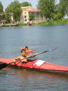
Spanish, which is how we communicated. She asked to let her and her friend to
try out my kayak, and
then became a sort of translator for me, helping me to find a room to stay
overnight with a local family. The house of the
family is reminiscent of one my family had lived in Taiwan almost 40 years
ago, with running water, electricity, chickens, but no flush toilet. The
wife Notsa and husband Neru live with their grandson, and the wife's aunt
and uncle live next door, etc., so they have deep family
roots in Sulina. Neru fishes and does tours using his motor boat.
They spoke little English, which was good for me to learn a some Romanian
using my phrase book (with their help). After a
home-cooked dinner (stewed catfish in a garlic vinegar sauce, and a soup of
tomato, potato, and parsley), I walked to the Black Sea beach (25 minutes),
past grazing cows and horses, for a relaxing swim. The water was refreshing
and the sands stretch softly far far out to sea.
Afterwards I went into the town center to look for an internet cafe, but
was told that it had closed. Sulina has the feel of a sleepy frontier town
trying to revive its faded glory, with
one supermarket, and a few bars and restaurants. Some roads are
unpaved dirt, and many houses and buildings (some with very nice
architecture) had fallen into disrepair. Still, there are signs of renewal,
with some houses and shops being remodelled and repainted.
.
.
.
.
My kayaking journey ended here. Next morning I caught the ferry back to Tulcea, from which I took a minibus back to Bucharest, where I stayed overnight before heading to the Otopeni airport early next morning for my return flight to Seattle.
Some technical info: The kayak I used is the FirstLight 480, which fits snugly (along with a PDF, bivy sack, small sleeping pad, clothing, etc.) into a Canyon Pack dry bag (with lumbar belt) made by Seattle Sports. The remainder of my belongings (maps, guidebook, pocket dictionaries/phrasebooks, repair kits, first aid, etc.) went into a small dry bag. I used a 2-piece fiberglass Epic paddle. The paddle and the kayak were the check-in luggages on my flights.
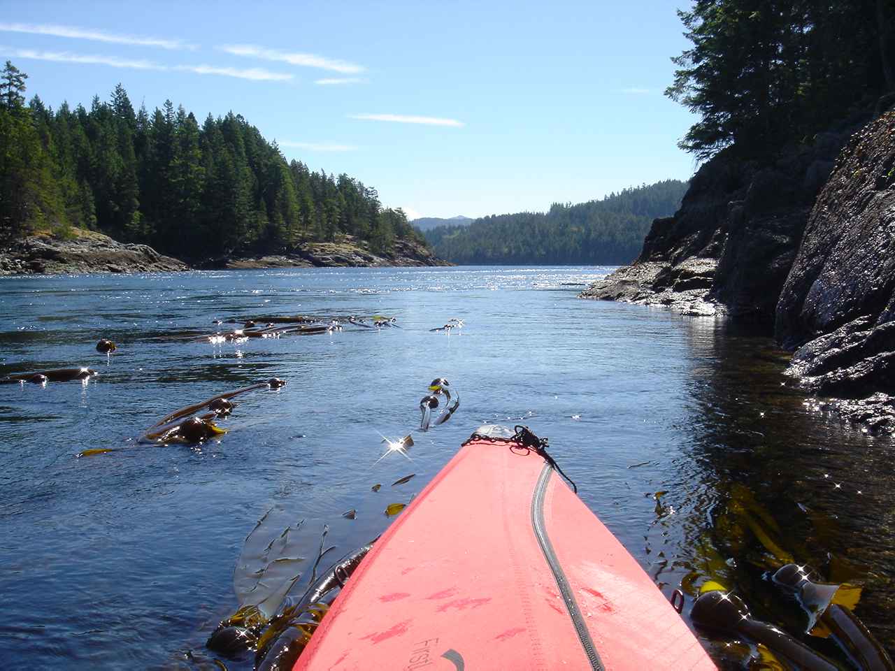 On the west coast of Canada, at the norther tip of the Strait of Georgia is a cluster of
islands called the Discovery Islands. Besides an abundance of marine life and sublime
natural beauty, there are narrow passages where whitewater surge during tide changes.
Here I was at Surge Narrow waiting for the tide to slacken before paddling through.
On the west coast of Canada, at the norther tip of the Strait of Georgia is a cluster of
islands called the Discovery Islands. Besides an abundance of marine life and sublime
natural beauty, there are narrow passages where whitewater surge during tide changes.
Here I was at Surge Narrow waiting for the tide to slacken before paddling through.
.
.
.
.

Beijing,
near main train station
The Yellow River, the second longest river in China, passes through nine provinces, starting at Qinghai, followed by Sichuan, Gansu, Ningxia, Inner Mongolia, etc., and ending in Shandong. It is thought to be where chinese civilization originated. What better way to experience this fabled river than by kayak? In September I packed my Firstlight 480 folding kayak and paddles for a flight to Beijing. Then a day-long train ride to Yinchuan, in Ningxia, and a taxi to the Yellow River shore. On the train ride to Yinchuan, a fellow passenger told of his involvement in illegal logging after it was banned for environmental reasons. Another passenger told of her divorce from a bad marriage. Corruption was another popular topic. A sort of group therapy session?
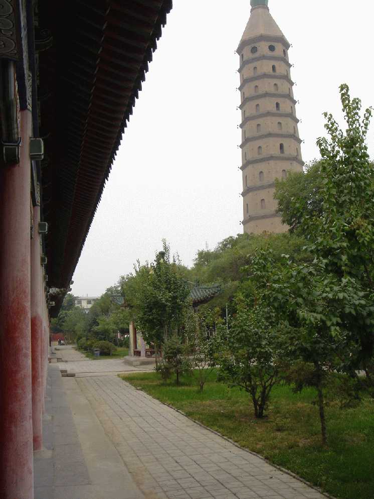
Yinchuan,
west pagoda
With my kayak assembled and enough water and food, I set off.
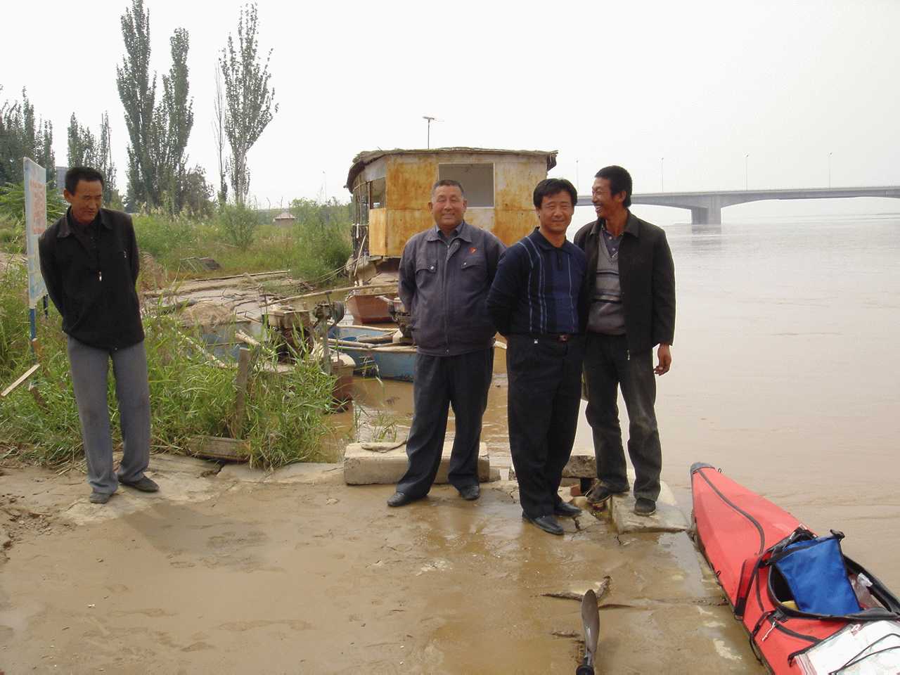
Yinchuan,
onlookers at river shore
.
.
.
.
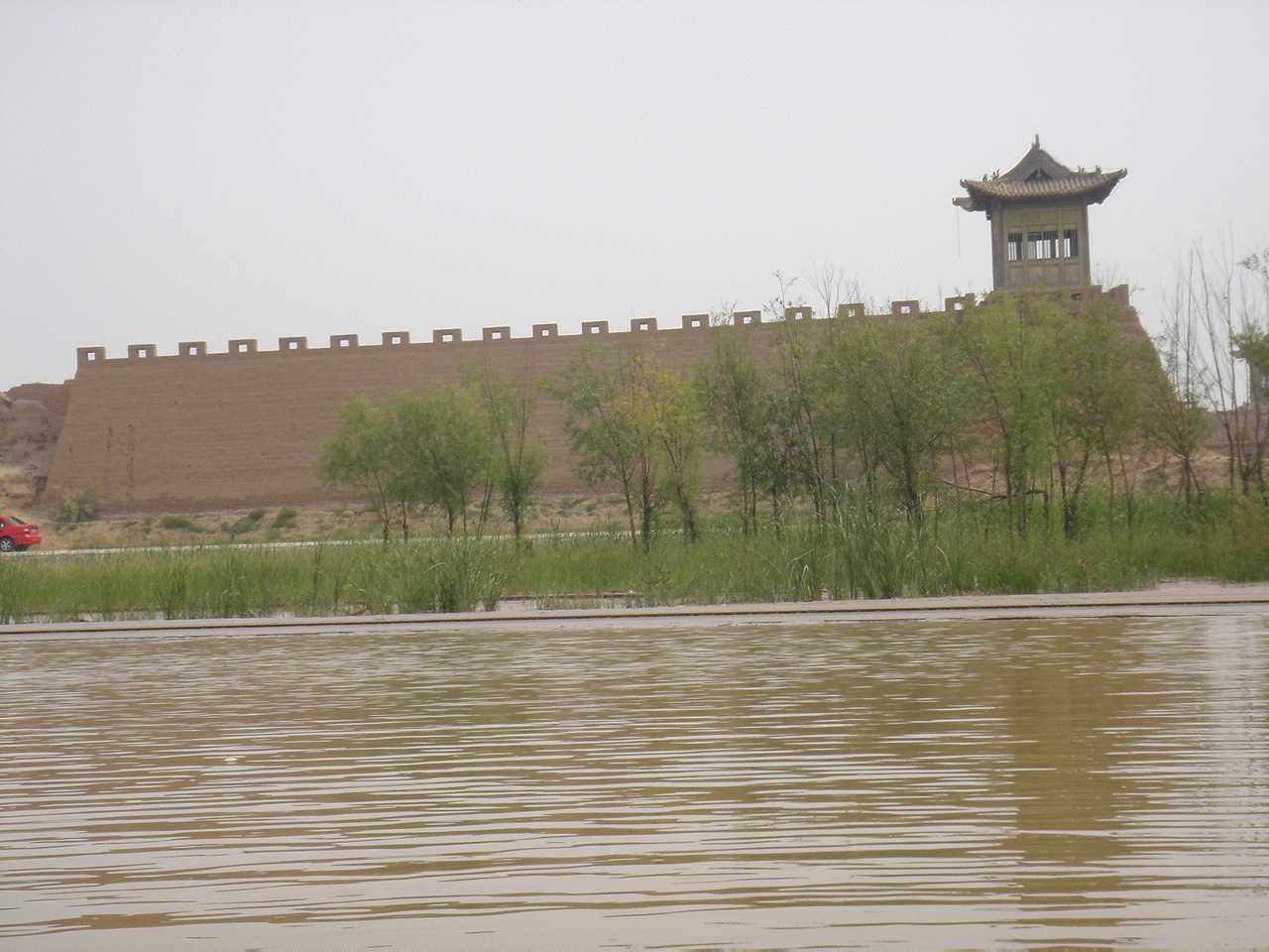
On this stretch, the Yellow River is languid, muddy, and the land is arid, sparsely populated, with only some shrubbery for vegetation. I passed by what looks to be the remnant of a mud brick wall, partially restored. The Great Wall?
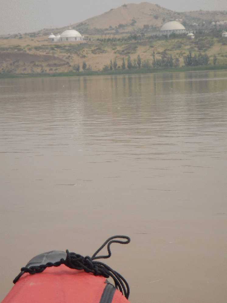
Mongolian yurts and domed mosques occasionally dot the shoreline.
Further on, the river widens and shallows into a broad expanse of marshes. Birds abound: swallows, egrets, herons, ducks, gulls, even a hawk. Some rice fields and mud huts.
Near night fall, a thunderstorm rolled in and, during a turn in swift current, I overleaned and my kayak capsized. I made a wet exit and pull the kayak, upside down, to shore, in a rice field. Lost bottled water, but nothing else. Water did enter the dry bag where my camera and passport were kept. The camera stopped working. Wet, cold, muddy, and tired, I dried and cleaned off, and crawled into my bivy sack. I was a bit angry at myself but was glad to finally rest. The night was chilly (this is late September near Inner Mongolia) and I regreted not bringing a sleeping bag, as I curled into a fetal position and shivered some through the night.
A thick fog shrouded the morning. Then it lifed, and the day brightened. In this flood plain, few people live near the water. And mud is everywhere, thick, deep, and sticky. Once I went ashore to seek water and found myself sinking thigh deep in mud. Luckily I was able to grab onto nearby rocks and pull myself out. In the late afternoon, I came within sight of the town of Shi-zui-shan and made camp on a treed mud flat on the opposite shore with a sunset view and a gentle breeze. Then the breeze died and hords of mosquitos forced an early retreat into my bivy sack for another chilly night of sleep.
Shi-zui-shan,
looking over the Yellow River
Shi-zui-shan, near the border with Inner Mongolia, was and remains a coal mining town. It has a growing commercial center, a newly paved 4 lane road by the river, and a rising skyline. Recently demolished homes of mud and bricks stand next to new apartment blocks. A new park was good for people watching (families and fishermen) and preparing my lecture in Beijing. A sand storm blew in to remind of the desert on the other side of the Helan mountain range. From near the slag heap of the main coal mine, one can look out over the town and see the contrasting changes. But Shi-zui-shan is still small by current chinese standards, with one shopping center and a city center concentrated within 6-8 blocks. It has a sizable indigenous muslim population, as well as immigrants from other provinces. One veteran miner told me stories of the mine and its hardships, and concerns about corruption and pollution.
Most touching is a little vegetable garden by the river, under a bridge, tended by a retiree and his wife. With tireless efforts, they converted this little dusty plot into a green fertile oasis. Now it is under threat from a government "beautification" project on the river shore.
.
.
.
.
.
.
.
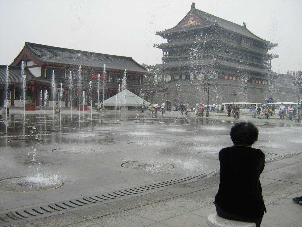
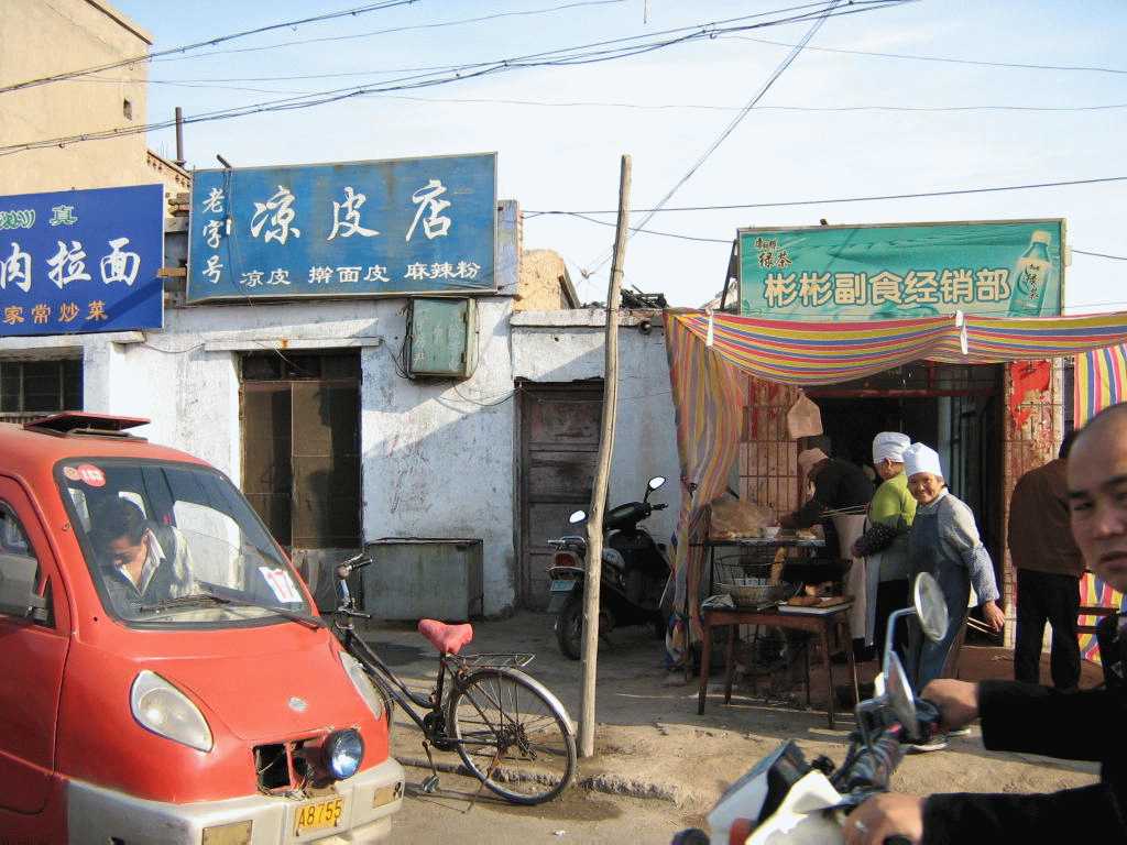
Xi-an,
old city gate
From Shi-zui-shan, I took an overnight sleeper bus (beds only!) to the ancient
city of Xi-an, did a strenuous day hike up granite-hewed Huashan (one of the five famous
mountains in China), and then took a train back to Beijing where I visited the Academy of Math and Systems Science and gave my lecture.
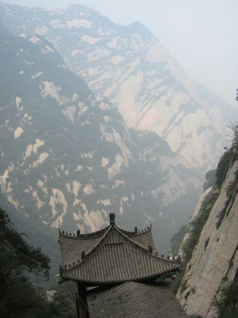
Huashan,
a Taoist temple along the ancient stone path
carved into the mountain side
.
.
.
.
.