 >
>
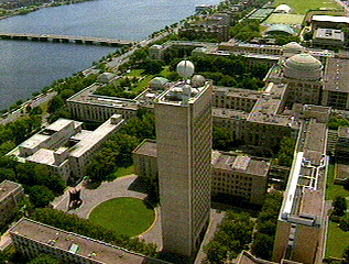
This is an aerial photograph of MIT. If you click on an area in the photo, you will get a description of whatever you clicked on. Cool, huh?
Note: this web page was created in 1995, when server-side image maps
were "cool", and I have not updated the descriptions or the links.
I'm leaving it up as-is for historical interest.